ChristchurchRakaiaHampdenToreaHaast BeachOtematataRangitataTwizelGreymouthTimaru
excellent water good fair poor not gradedOpen the full map →Map: LINZ Topo50 (LINZ Basemaps), CC BY 4.0

Good places to start

Where a public road reaches the water and you can walk a public bank, healthiest water first: insect life (the food trout live on) graded good or excellent, then the most public land beside the water within 1 km.

  1. Haast River at the Haast Highway bridge
    Good waterFairly clearPublic bank
    More about this spot

    Road bridge · River · Public land beside most of the water within 1 km

    Insect life good · usually fairly clear, about 1.8 m visibility · nitrate low · catchment mostly native forest

    See it on the map Bank private further along? Tap the property to ask the landowner

  2. Arawhata River at the Haast-Jackson Bay Road bridge
    Good waterFairly clearPublic bank
    More about this spot

    Road bridge · River · Public land beside most of the water within 1 km

    Insect life good · usually fairly clear, about 2.8 m visibility · nitrate low · catchment mostly native forest

    See it on the map Bank private further along? Tap the property to ask the landowner

  3. Taramakau River at the Kumara-Inchbonnie Road bridge
    Good waterFairly clearPublic bank
    More about this spot

    Road bridge · River · Public land beside most of the water within 1 km

    Insect life good · usually fairly clear, about 2.6 m visibility · nitrate low · catchment mostly native forest

    See it on the map Bank private further along? Tap the property to ask the landowner

  4. Otututu / Rough River at the Atarau Road bridge
    Good waterClearPublic bank
    More about this spot

    Road bridge · River · Public land beside most of the water within 1 km

    Insect life good · usually clear, about 3.5 m visibility · nitrate low · catchment mostly native forest

    See it on the map Bank private further along? Tap the property to ask the landowner

  5. Waikiti River at the Haupiri-Amuri Road bridge
    Good waterClearMarginal strip
    More about this spot

    Road bridge · Stream · Marginal strip beside most of the water within 1 km

    Insect life good · usually clear, about 6.9 m visibility · nitrate low · catchment mostly native forest

    See it on the map Bank private further along? Tap the property to ask the landowner

  6. Upper Grey River at the Palmer Road bridge
    Good waterClearPublic bank
    More about this spot

    Road bridge · Stream · Public land beside most of the water within 1 km

    Insect life good · usually clear, about 3.8 m visibility · nitrate low · catchment mostly native forest

    See it on the map Bank private further along? Tap the property to ask the landowner

  7. Inangahua River at the State Highway 7 bridge
    Good waterClearPublic bank
    More about this spot

    Road bridge · Stream · Public land beside most of the water within 1 km

    Insect life good · usually clear, about 4.6 m visibility · nitrate low · catchment mostly native forest

    See it on the map Bank private further along? Tap the property to ask the landowner

  8. Ōtira River at the Otira Highway bridge
    Good waterFairly clearPublic bank
    More about this spot

    Road bridge · Stream · Public land beside most of the water within 1 km

    Insect life good · usually fairly clear, about 2.9 m visibility · nitrate low · catchment mostly mountains

    See it on the map Bank private further along? Tap the property to ask the landowner

  9. Ōmoeroa River at the Fox Glacier Highway bridge
    Good waterClearPublic bank
    More about this spot

    Road bridge · Stream · Public land beside most of the water within 1 km

    Insect life good · usually clear, about 4.5 m visibility · nitrate low · catchment mostly native forest

    See it on the map Bank private further along? Tap the property to ask the landowner

  10. Greenstone River / Hokonui at the Kumara-Inchbonnie Road bridge
    Good waterClearPublic bank
    More about this spot

    Road bridge · Stream · Public land beside most of the water within 1 km

    Insect life good · usually clear, about 4 m visibility · nitrate low · catchment mostly native forest

    See it on the map Bank private further along? Tap the property to ask the landowner

How we choose these places
  • A public road reaches the water. A road bridge, checked against LINZ’s legal road records (the topographic map also shows some private roads), an unformed legal road, or a road within 60 m of a lake.
  • The bank near it is public. A marginal strip, conservation land, a national park or a reserve beside at least a quarter of the water within 1 km, so you have somewhere to walk and fish.
  • There’s water in it in summer. MfE’s modelled low flow for a typical dry summer is at least 0.5 m³/s: enough water to fish. “Stream” is up to 3 m³/s, “river” above.
  • Healthiest water first. Insect life (MCI, the food trout live on), typical visibility and what the catchment above is mostly, from MfE’s national water quality records for 2016–2020, graded with the government’s NPS-FM bands. Modelled for every river; measured where a monitoring site is within 500 m, and the place says so. Lakes aren’t graded. Big braided and glacier-fed rivers grade lower naturally (shifting gravel and silty snowmelt keep insect life down); low nitrate and a mountain catchment tell that apart from farming.
  • It’s from national records, not a visit. A stream lined with willows can look dry from the air, a bridge can be closed, and a model can be wrong for one stream. If a place isn’t what it should be, tell us.

What you might catch on the West Coast

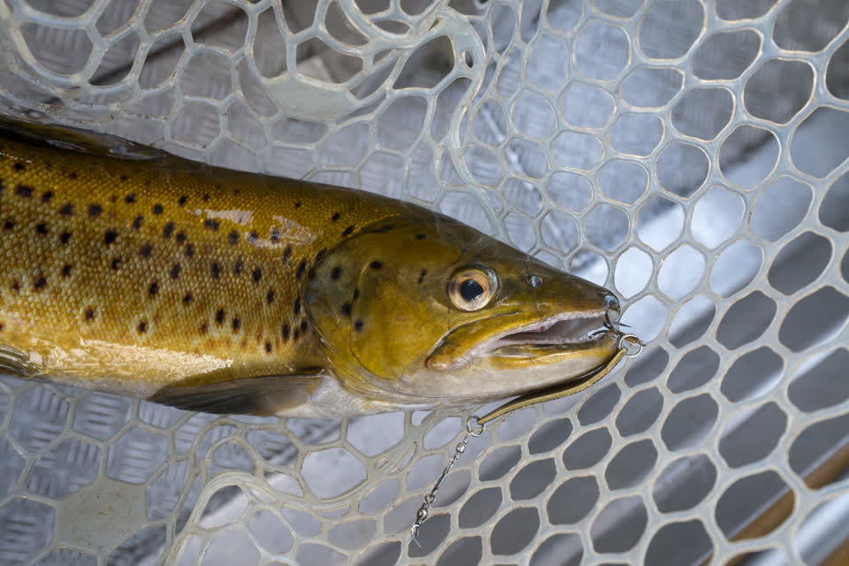
  • Brown trout
    Brown trout

    The wary, widespread trout of rivers and lakes, from the Waikato south.

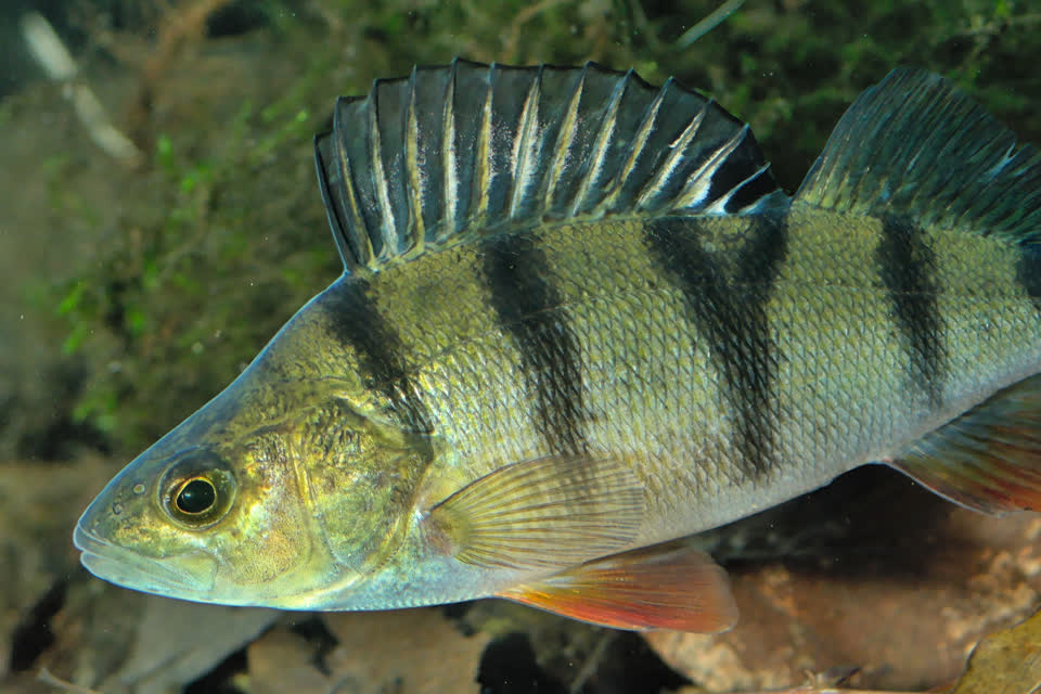
  • Perch and coarse fish
    Perch and coarse fish

    Perch, tench and rudd in lowland lakes and ponds: easy fishing and a good start for children.

From NIWA and Fish & Game’s descriptions of where each fish lives, region by region; a particular river may not hold them.

Know the river you want?

The longest rivers on the West Coast

RiverLength, aboutPublic land beside the waterUnformed roads reaching itInsect lifeMap
Maruia River86 km48% (7 km marginal strip)38goodMap
Buller River82 km50% (2 km marginal strip)45goodMap
Taramakau River81 km98% (10 km marginal strip)36goodMap
Inangahua River75 km50% (1 km marginal strip)43goodMap
Grey River / Māwheranui68 km57% (20 km marginal strip)47goodMap
Hokitika River66 km95% (4 km marginal strip)51goodMap
Haast River64 km98% (1 km marginal strip)17goodMap
Landsborough River58 km100%2goodMap
Arahura River56 km0%5goodMap
Waiatoto River55 km97%8goodMap
Whataroa River55 km74% (3 km marginal strip)12goodMap
Cascade River50 km91%–goodMap
Wanganui River49 km100% (6 km marginal strip)15goodMap
Arawhata River48 km100%2goodMap
Ahaura River48 km95% (3 km marginal strip)13goodMap

Lakes

LakeAreaShore with public landMap
Lake Brunner / Moana4,059 ha92% of 46.5 kmMap
Lake Kaniere1,470 ha98% of 25.2 kmMap
Lake Mapourika893 ha100% of 18 kmMap
Lake Hochstetter523 ha64% of 13 kmMap
Lake Paringa475 ha100% of 15.2 kmMap
Lake Ianthe / Matahi471 ha100% of 10.3 kmMap
Lake Ellery388 ha100% of 12.4 kmMap
Lake Mahinapua380 ha24% of 11.1 kmMap

Before you go

  • Licence and rules. A Fish & Game licence, and the rules of the Fish & Game region you fish (seasons, limits and methods differ from water to water): Fish & Game licences and rules.
  • Check, Clean, Dry between every river and lake. How, from MPI.
  • Private bank. Where the bank is private, ask first. Find the block on the map, and we work out the postal address without showing you who owns it: you print one page, they scan the code and answer. The Outdoor Access Code on fishing.

Open the fishing map Hunting on the West Coast

Places to start: a public road meets the water (bridges checked against LINZ legal road records), public land is beside at least a quarter of the water within 1 km, and MfE’s modelled summer low flow is at least 0.5 m³/s (“stream” up to 3, “river” above). Rivers measured on a 100 m grid so braided rivers count once; lengths run about 10% short of official figures because the grid cuts across bends. “Public land beside the water” means a marginal strip, conservation land, a national park or a reserve within 25 m of the river (nature reserves and wildlife areas left out); a road “reaches” the water within 15 m. River names are LINZ’s 2018 pilot and not always official. Figures from 2026-10-05. Rivers and lakes: LINZ NZ River Name Lines and Polygons (Pilot) and NZ Lake Polygons (Topo 1:50k), CC BY 4.0. Roads: LINZ NZ Road Centrelines (Topo 1:50k) and Primary Parcels, CC BY 4.0. Summer low flow: MfE River flows, CC BY 3.0 NZ. Public land: LINZ Protected Areas, CC BY 4.0. Unformed legal roads: Herenga ā Nuku Aotearoa, CC BY 3.0 NZ.